VOYAGER COMPUTER
A fully functional GPS computer every snowmobiler should have and use. Whether you’re a backcountry rider, trail runner, distance traveler, or boondocker, this computer will give you all the tools to make your ride even more enjoyable. With features like a fully programmable and updateable GPS unit, speed, distance, compass, temperature and altitude functions, you’ll have the assurance of knowing where you are, how to get back, and the status of your machine. This unit is easy to use and has an easy to read screen for day and nighttime riding.
Display: The Voyager 400x240 WQVGA LCD display has no rival on the market, featuring incredible resolution and contrast. In intense sunlight the transflective properties go to work creating a bright, vivid display. An LED backlight lights the display after the sun goes down.
Smart Data Logging: When your engine stops so does the GPS trail logging – eliminating random data points from your track when you’re not moving. Voyager provides clear, accurate tracks even in the toughest terrain.
Sharing: Use OHVtrails.net to download and share your favorite trails. Explore new trail areas with confidence. Voyager also offers on and off the trail file sharing between units via the waterproof MicroSD card (reads most GPS brands.)
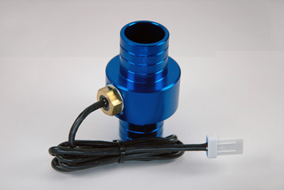
Temperature:Voyager provides both ambient and engine temperature. Engine temperature is saved in track data points and graphed for comparison with altitude changes. Diagnostic screens help you review engine performance from past trails. Will work on either air-cooled or liquid cooled machines.
-
GPS Speed, Distance, Compass,
Altitude, Temperature, Maps
-
2.7” 400x240 WQVGA LCD
-
Readable in the brightest sunlight
-
Engine performance linked to GPS data
-
Crash resistant, includes a handlebar mount with a universal bracket
-
Upload routes from any GPS or PC
-
Purpose designed mounting
-
Customizable user screens
-
Accepts AC or DC power from
virtually any vehicle
-
Rugged handlebar mounts - 7/8” to 1-1/8”
-
Waterproof
-
Track Manager CD: View, edit, organize and share entire trail systems in 3D.
-
Screens: Data is intuitively arranged and quickly accessed using joystick navigation.
-
Diagnostics: Altitude vs. Engine Temperature profiling for advanced GPS diagnostics.
-
Mapping: Accurate tracks, even in the toughest terrain. Pan, zoom, graphs, waypoints, and more.
-
Sharing: Waterproof, easy access MicroSD card reader allows sharing of routes, even on the trail